Active Travel, Walking + Cycling
Castle Hill – Cudtheringa Track Closure
Updated: 14 April 2025
Castle Hill Road has now reopened to vehicles. However, the Castle Hill Cudtheringa Track still remains closed at this stage.
 Improve your outlook, get active outdoors!
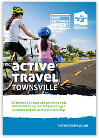
Townsville has many great walkways and bikeways throughout the city. Find out more by reading this page or by downloading our:
- Active Travel Booklet (PDF, 7.3 MB)
Remember: it only takes 6 minutes to burn so make sure you are prepared before you go out in the sun!
To find out more about cycling and hiking trails in our national parks please visit the Queensland Government website.
10,000 Steps Walkway
Townsville has a number of 10,000 Steps signed walkways or circuits to help you achieve your 10,000 steps per day – which is the recommended daily step goal for a healthy adult.
You can find signed 10,000 steps circuits at the following locations:
- Anderson Botanic Garden Circuit
- Distance: 1554m
- Steps: 1942
- Riverway Circuit
- Distance: 3700m
- Steps: 4625
- Ross River Parkway Aplins Circuit
- Distance: 5300m
- Steps: 6625
- Rowes Bay to Pallarenda
- Distance: 4000m
- Steps: 5000 (one way)
- Wetlands Circuit
- Distance: 5860m
- Steps: 7325
Castle Hill Tracks
- Castle Hill Road Start to Top Carpark
- Distance: 2600m
- Steps: 3250
- Cudtheringa Track to Top Carpark
- Distance: 1136m
- Steps: 1420
- Dianella Track to Top Carpark
- Distance: 1021m
- Steps: 1276
- Goat Track to Top Carpark
- Distance: 1052m
- Steps: 1315
- Ironbark Track to Top Carpark
- Distance: 1744m
- Steps: 2180
10,000 Steps has been developed by CQUniversity Australia.
Arcadia Coastcare Nature Walk
Heading to Magnetic Island? Arcadia Coastcare have put together a guide to the native plants of their little slice of Magnetic Island. Go on one of their walking routes to learn about some of the amazing plants you can find around Alma Creek and Alma Bay, Old Jetty Road, and Geoffrey Bay.
Booroona Trail
The Booroona Trail offers the perfect opportunity for people to get closer to their environment with its attractive boardwalks, peaceful seating areas and harmony with the surrounding environment. The walking trail has improved the local river area dramatically and has also helped to foster a sense of community along the Ross River.
Blending man-made elements into the wetlands environment, the Booroona Trail provides the community with a safe place to experience a unique ecosystem with boardwalks, bridges, seating, plants and trees, overall beautification of the area and importantly, conservation and ongoing protection of native species.
Residents and visitors can enjoy the walking trail by accessing it from Upper Ross River Road at Apex Park or Loam Island.
Castle Hill
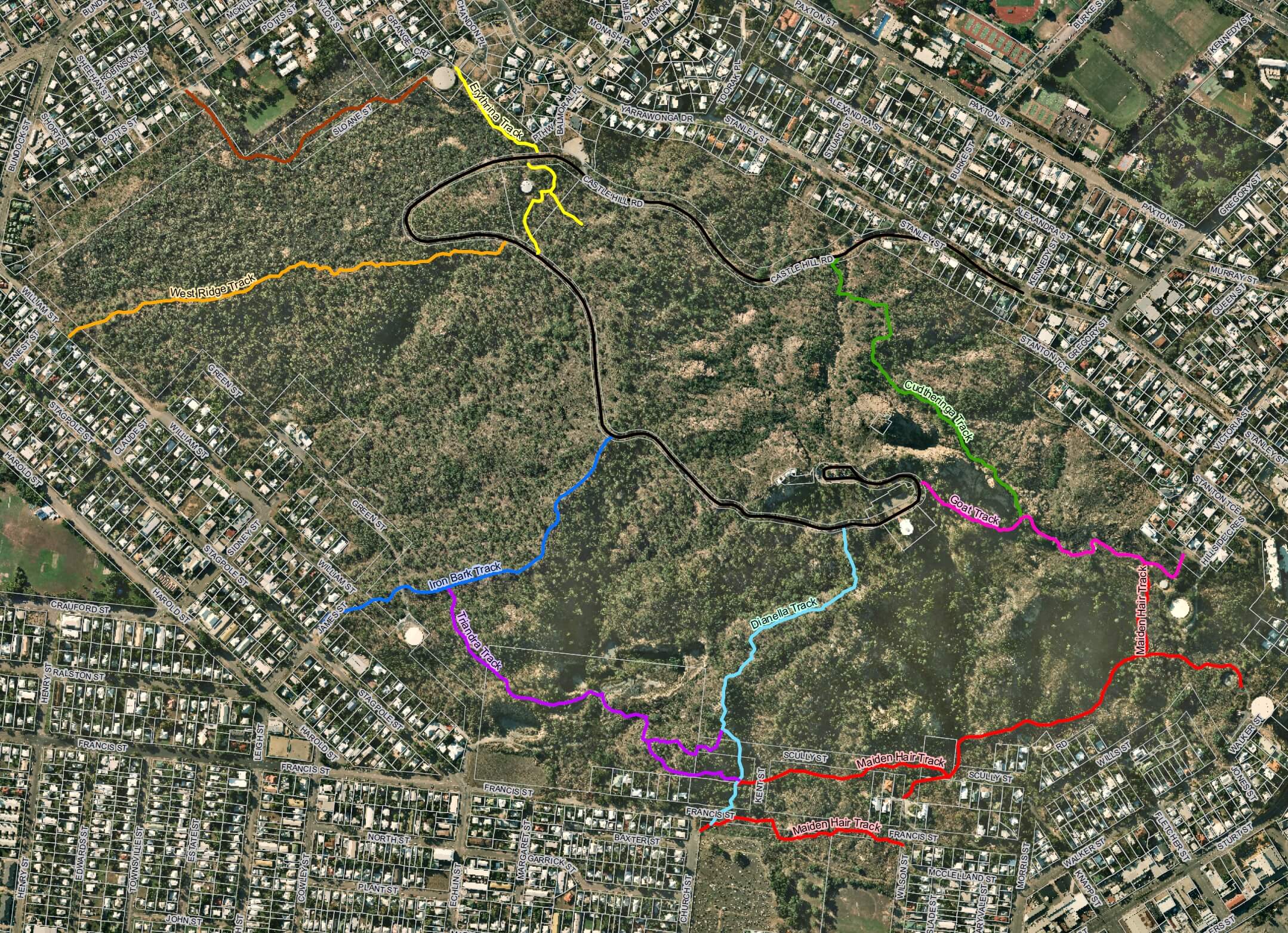
Castle Hill is the most popular walking trail within Townsville City – boasting a number of walking trails it is a great way to get fit and be active. From the circular road (3.3km one way) to the more intensive Cudtheringa or Goat tracks Castle Hill is a great place to work out for any fitness level.
Track Information

- Cudtheringa Track (Green)
- Distance: 760m
- 1.5km from start (Kennedy St) to Castle Hill carpark via Goat Track
- Dianella Track (Light Blue)
- Distance: 1.1km
- From start (Church St) to Castle Hill carpark
- Erythrina Track (Yellow)
- Distance: 500m
- 1.8km from start (Grange Crt) to Castle Hill carpark
- Goat Track (Pink)
- Distance: 720m
- 860m from start (Hillside Cres) to Castle Hill carpark
- Iron Bark Track (Dark Blue)
- Distance: 775m
- 1.7km from start (James St) to Castle Hill carpark
- West Ridge Track (Orange)
- Distance: 940m
- 2.2km from start (William St) to Castle Hill carpark
- Iron Bark Track (Dark Blue)
- Distance: 775m
- 1.7km from start (James St) to Castle Hill carpark
- Maiden Hair Track (Red)
- Distance: 1.2km
- 1.9km from start (Church St) to Castle Hill carpark via Dianella, Maiden Hair and Goat Tracks
- 1.5km from start (Wilson St) to Castle Hill carpark via Goat Track
- 1.2km from start (Walker St) to Castle Hill carpark via Goat Track
- Triandra Track (Purple)
- Distance: 850m
- 2.6km from start (James St) to Castle Hill carpark (via Iron Bark, Triandra, Maiden Hair and Goat Tracks)
- 1.6km from start (James St) to Castle Hill carpark (via Iron Bark, Triandra and Dianella Tracks)
Share the Hill Safely
Castle Hill is an iconic feature and as a popular and greatly utilised area by many people in our community, it is also important to take care and be safe when using it for exercise or recreation. Everyone has a personal responsibility to share the space safely with others in the community.
Signage has recently been installed along the roadway on Castle Hill. These signs are important reminders to all users:
- Cyclists watch your speed, look out for signs, other roads users and do not exceed 40km per hour. Please ensure that you warn pedestrians and reduce your speed.
- Walkers and runners must walk no more than two people across – this allows safe space for all users, including cars and cyclists.
Watch the video to better understand how you can share the hill safely with everyone:
Whether you ride, drive, walk or run – please share Castle Hill safely with everyone!
Gabul Way
The 710m walkway is adjacent to Arcadia Road and is made up of 2 sections – suitable for walkers and cyclists.
Geoffrey Bay towards Nelly Bay is 350m in distance and leads to the first of two viewing platforms. This section is disable access compliant. Nelly Bay towards Geoffrey is 360m in distance and mostly elevated, with several break out areas to enjoy the vistas from.
Heritage and Cemetery Walks

A perfect way to see the city and learn about its rich history, architecture and people.
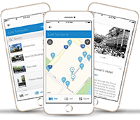
Download the Townsville Tours & Trails app:
Or view our heritage and cemetery walks brochures for self-guided tours around Townsville.
Heritage walks:
- Trail 1 – Civic Pride (PDF, 3.2 MB)
- Trail 2 – Early Townsville (PDF, 1.4 MB)
- Trail 3 – South Townsville and Port (PDF, 3.2 MB)
Cemetery walks:
Magnetic Island Trails Vision Plan
The Magnetic Island Trails Vision Plan is a joint initiative between Townsville City Council and the Queensland Parks and Wildlife Services.
The trails plan identifies existing and future pathways and bush walking track connections linking the island’s major hubs and attractions.
Community engagement on the plan was undertaken in mid 2019.
The trails plan will guide future investment in the trails network and target funding opportunities.
Magnetic Island Trails Vision Plan (PDF, 10.4 MB)
Mount Louisa
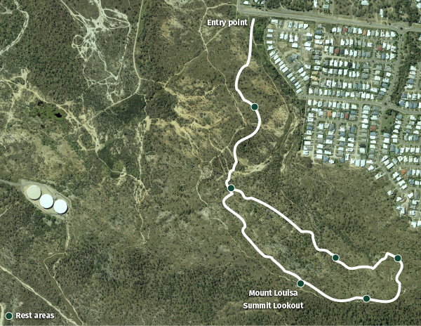
The Mount Louisa Walking Track is located in the heart of Mount Louisa off Bayswater Road, near Weston Street.
The track loop is over 3.5km long and features more than 1,700 steps. Along the track, you will find viewing areas with panoramic views of the city and interpretive signage to discover. It is a Class 3 walking track containing steep grades, loose surfaces, uneven steps and minimal infrastructure.
There’s no water at the summit, so remember to bring a water bottle and fill up at the track entry.
Images of what you can expect on the track:
- signage along the Mount Louisa Walking Tracks (JPG, 1.4 MB)
- naturally styled rock steps leading up to the Mount Louisa Summit Lookout (JPG, 1.2 MB)
- a city view from the top of the Mount Louisa Summit Lookout (JPG, 974.7 KB).
Pioneers of Townsville
A brief history of the women and men who helped shape Townsville as we know it today.
- Pioneers Walk – Andrew Ball (PDF, 847.9 KB)
- Pioneers Walk – Catherine Robinson (PDF, 1.5 MB)
- Pioneers Walk – Eddie Mabo (PDF, 224.7 KB)
- Pioneers Walk – James Morrill (PDF, 1.1 MB)
- Pioneers Walk – Joan Innes-Reid (PDF, 143.4 KB)
- Pioneers Walk – John Melton Black (PDF, 860.9 KB)
- Pioneers Walk – Philip Leong (PDF, 924.3 KB)
- Pioneers Walk – Robert Hayles (PDF, 1.2 MB)
- Pioneers Walk – Robert Towns (PDF, 1.6 MB)
- Pioneers Walk – Rose Ball (PDF, 1004.9 KB)
- Pioneers Walk – Sister Elizabeth Kenny (PDF, 729.9 KB)
Riverwalk, Ross River Parkway
The Riverwalk overlooks the beautiful Ross River and is a great place to view the prolific birdlife in this area. A 3-metre wide pathway runs along the river and provides numerous opportunities to enjoy its natural beauty. After taking a stroll, all the family can enjoy the nearby barbecue facilities provided or have a game of footy in the beautifully landscaped open space.
Download the Ross River Parkway Guide:
Please note: each page is A3 sized to preserve clarity of information. These documents contain images and diagrams, and may be incompatible with interpretive software.


